Importing Point Features
Point features can be imported as points (zero length lines), cells, or text.
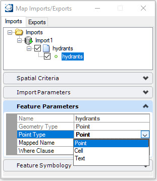
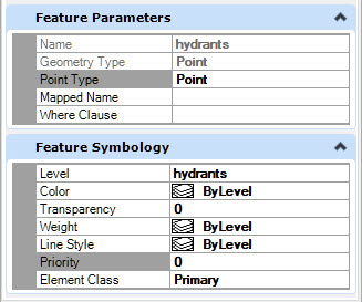
Point
When the Point type is selected, the Feature Symbology pane is available to specify the following settings: level, color, transparency, weight, line style, priority, and element class. These settings are available for all feature types.
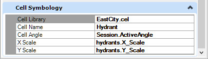
Cell
When a point is set to a cell, the Cell Symbology pane opens which allows you to specify the Cell Library, Cell Name, Cell Angle, X Scale, Y Scale and Z Scale (3D only) The angle and scale values can be entered as:
- Session value - the active angle and active scale
- Feature property - the value of the property
- Explicit value - the entered value
If you are importing into a design file opened with an OpenCities Map geospatial project, the feature can be mapped to a feature definition from the project. Mapped features will obtain their symbology from the feature definition specified in the geospatial project. The Cell Symbology pane will not appear.
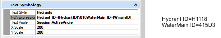
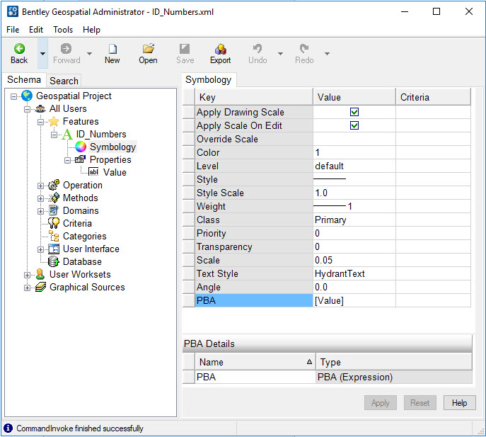
Text
When a point is set to a text, the Text Symbology pane opens which allows you to specify the Text Style, PBA Expression, Text Angle, X Scale, Y Scale, and Z Scale (3D only). The angle and scale values can be entered as:
- Session value - the active angle and active scale
- Feature property - the value of the property
- Explicit value - the entered value
When importing into a design file without an OpenCities Map geospatial project, PBA Expressions (Property Based Annotation) allows you to place specific property values as the text string. The selected property can be picked from the list of available properties or be keyed-in inside of square brackets. The name of the property is case sensitive. Multiple properties can be put on separate lines by using \010 to indicate a new line. The PBA expression can contain literal text.
When importing into a design file opened with an OpenCities Map geospatial project, the incoming feature is mapped to a feature definition in the project. If the feature is defined as a point text feature, specify a symbology PBA key to the property to be used as the text string. The simplest method is to define a PBA (Expression). If this is not included in the feature definition, the text will be imported as a zero-length line element.
Mapped features will obtain their symbology from the feature definition specified in the geospatial project.